Green, Wet, and Really Pretty
Let's get this out of the way right now: I didn't really see Ireland. I mean, I saw some Ireland. Quite a bit of the pretty parts, actually. But if you're looking for a guide to Dublin's pubs, Galway's food scene, or what Cork is like as a city, you're in the wrong place. I flew into Dublin airport, got in a rental car, spent a week driving west and following the coast south, then flew back out. No cities. Not one. Cork was technically on the route, but I arrived at 7 PM, got something to eat, some drinks, and left the next morning. So that counts for exactly nothing.
My route: Dublin airport to Birr (a small midlands town I used as a first-night stop), then west to the Cliffs of Moher, down the Wild Atlantic Way, around the Ring of Kerry, a quick overnight in Cork, and back to Dublin airport with a few detours along the way. Think of this page as a rural Ireland road trip report, not a country guide. If you want the full picture, you're gonna need more than this.
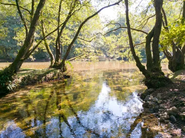
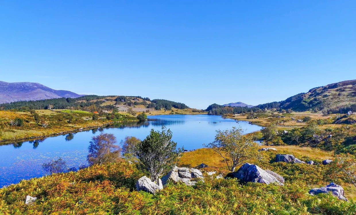
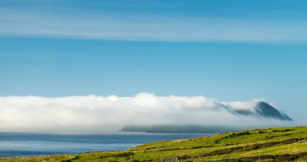
And look, even with this limited route, Ireland works. The green is real. Not in a mystical, soundtrack-swelling way. More in a "someone got a bit enthusiastic with the saturation slider" way. Every field, every hill, every roadside strip of grass has that deep, stubborn green you get when the sky waters it every 90 minutes. You don't get this green for free. The invoice arrives as rain.
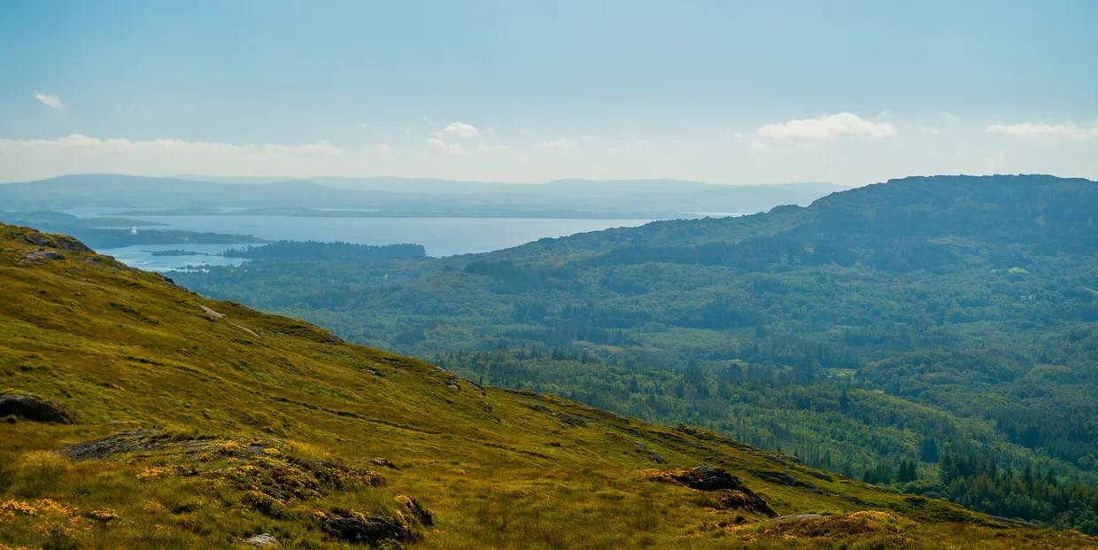
The west coast is a very good road trip if you like cliffs, empty beaches, old stones, and being outvoted by sheep. Some of it is plainly good-looking, but the charm is also in the practical nonsense: roads that were apparently measured with optimism, signs that appear after the turn, weather that changes its mind mid-sentence. Also: sheep. So many sheep. They will be on the road. They will not move. You will wait.
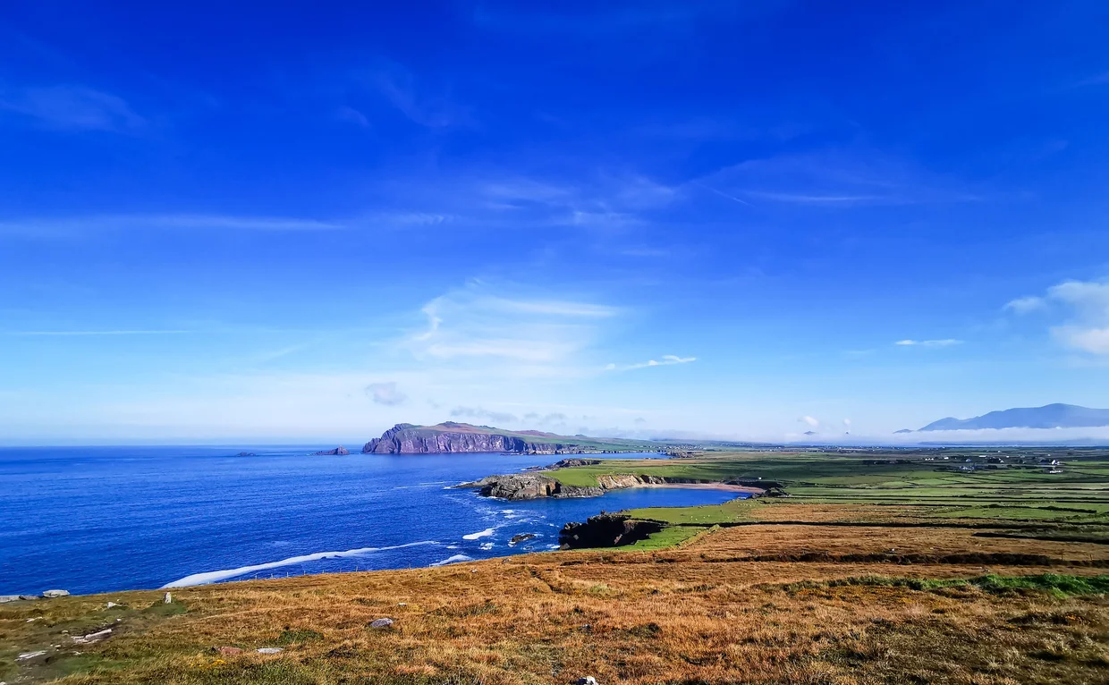
Cliffs of Moher
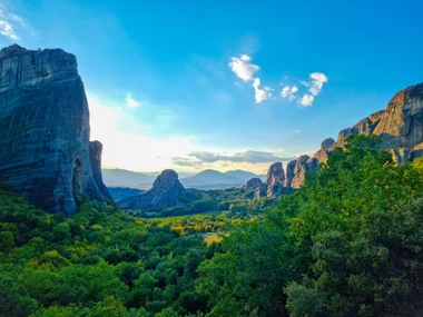
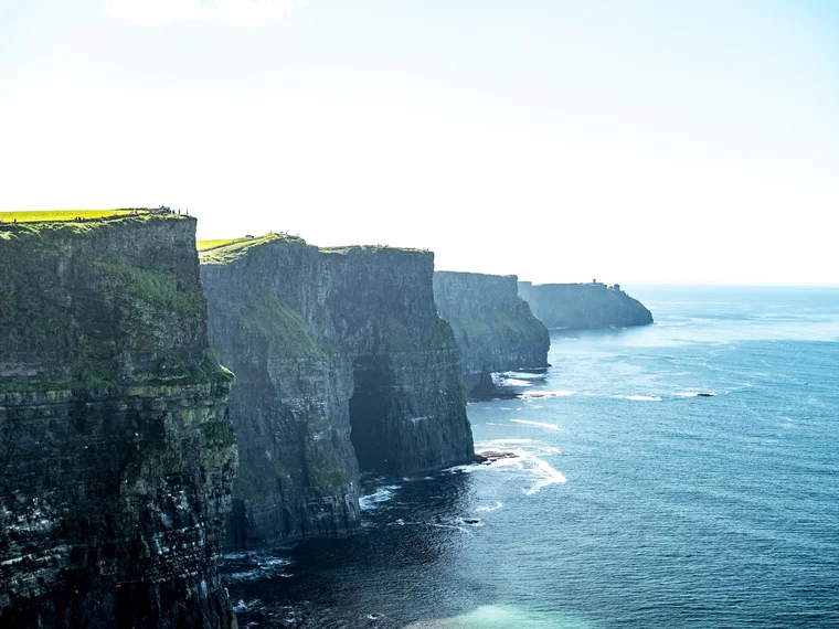
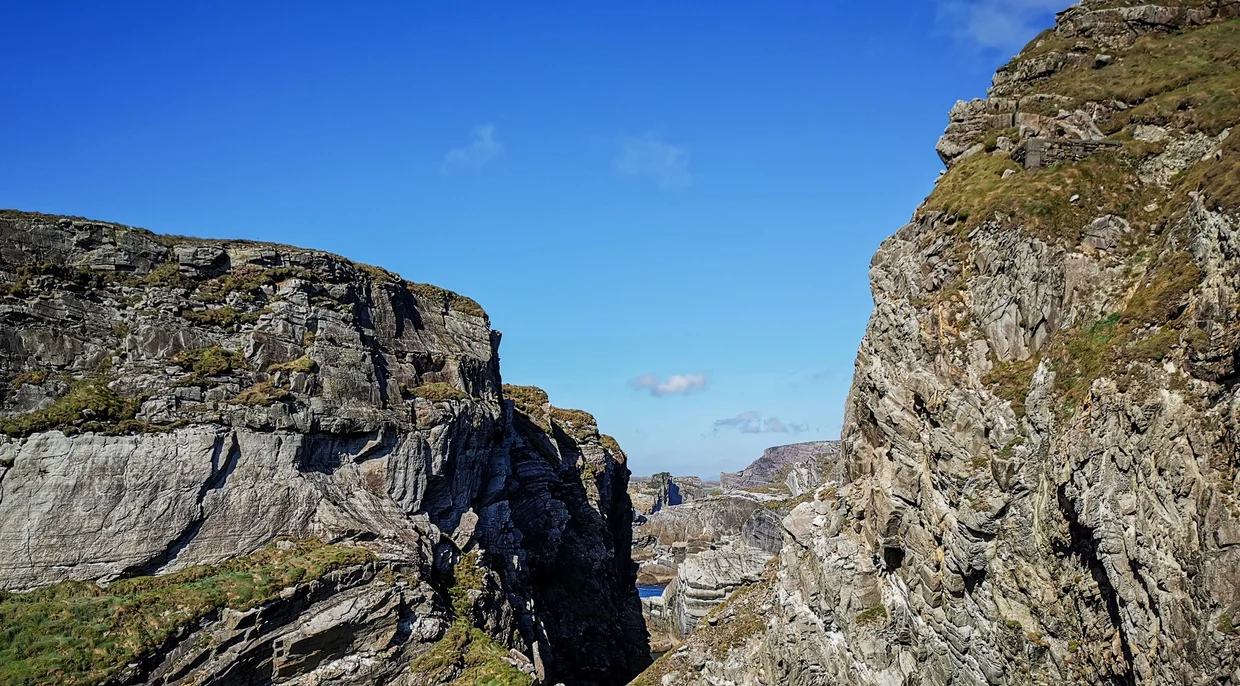
You know the Cliffs of Moher. You've seen them. Every tourism ad for Ireland uses them. Every "places to visit before you die" list seems legally required to include them. Normally that kind of hype is where disappointment starts warming up. The Cliffs of Moher mostly hold up.
The cliffs run for about 14 kilometers along the Atlantic coast of County Clare, rising up to 214 meters above the sea. When you first walk up to the edge (there's a paved path, don't worry), your brain takes a second to process the scale. The drop is sheer. The ocean below is loud and white. And it just keeps going, cliff after cliff after cliff, curving away into the distance until it fades into haze.
O'Brien's Tower sits at the highest point and gives you the best panoramic view. On a clear day (big "if" in Ireland), you can see the Aran Islands and the distant outline of Connemara. On the day I went, the sky was blue enough to make the tourism board look honest, which is always unsettling.
The visitor center charges an admission fee, and that fee includes the official parking, visitor center facilities, paved viewing paths, and O'Brien's Tower access. The cliffs themselves are not a theme park attraction behind a gate, but if you use the main Cliffs of Moher Experience setup, you're paying for the managed site around them.
Current trail note: Parts of the longer Cliffs of Moher Coastal Walk have been closed for safety works, including sections toward Hag's Head and north of the visitor center. Check the official trail status before planning a proper hike. The main visitor center viewpoints are still the straightforward option if you just want the classic cliff views.
Practical note: The cliffs are not fully fenced. Some sections have low stone walls, some have nothing at all. The wind at the top can be strong enough to push you sideways. If you're bringing kids, hold onto them. And please, for the love of everything, don't sit on the edge with your legs dangling for a photo. I watched someone do this and my palms are still sweating.
Destination Info
Quick Facts
Overview
- Best 7 to 10 days in May till September.
- At Sea level in Europe, time zone UTC+0 (UTC+1 DST).
- The population of 5.2M people speaks English, Irish (Gaeilge), writes in Latin script.
- Euro (EUR) is the official currency, and tipping is not expected (rounding up appreciated).
Local Flavor
- Get a Guinness and Irish stew.
- The main festival here is St. Patrick's Day.
Practicalities
- You can use Buses, trains (limited outside cities) for public transportation, while driving on the left.
- You can get here mostly via Dublin (DUB), Cork (ORK), Shannon (SNN).
- The best area to stay is Killarney.
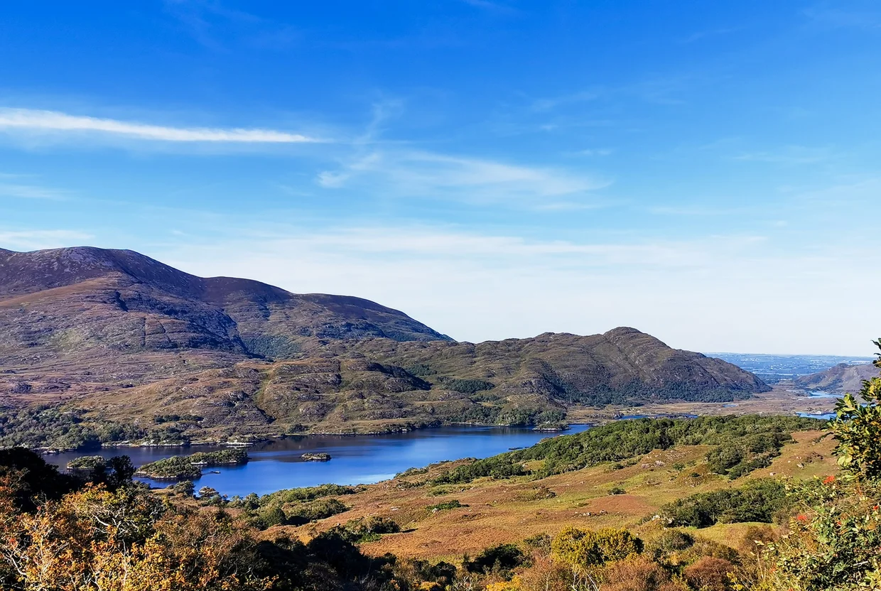
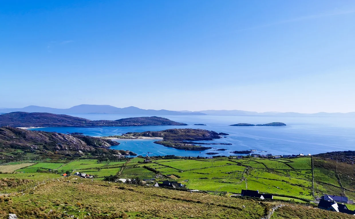
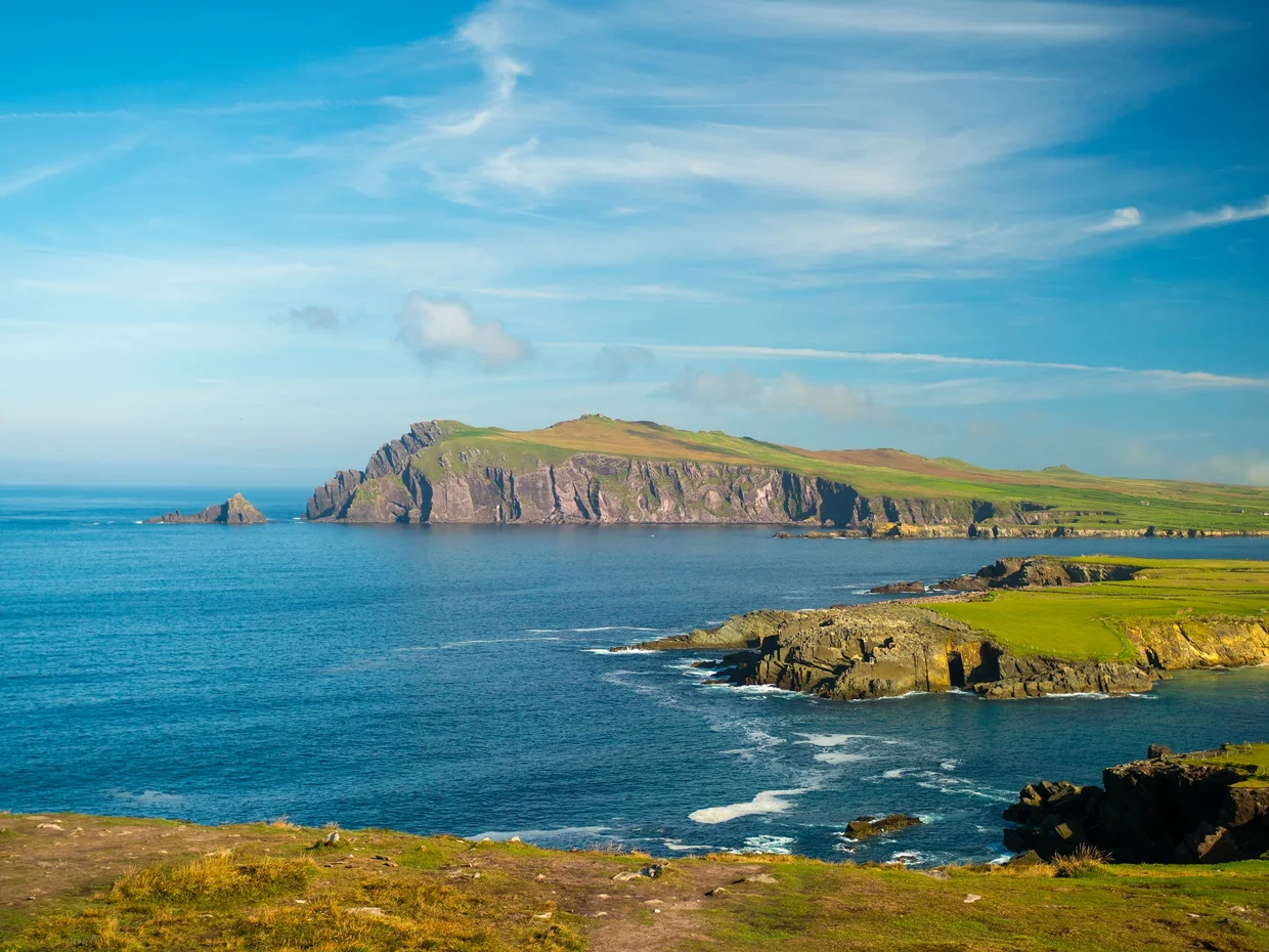
The Ring of Kerry
The Ring of Kerry is a 179-kilometer loop around the Iveragh Peninsula in the southwest, and it's one of those drives where progress becomes beside the point. The road hugs the coast, cuts through mountains, dips into valleys, threads through tiny villages, and keeps handing you reasons to stop, which is inconvenient if you had a schedule.
Most tour buses drive the Ring counterclockwise, via Killorglin first, because the roads are narrow and coaches do not want to meet each other head-on in the worst places. Advice for drivers is split: clockwise means you are less likely to sit behind a bus convoy, while counterclockwise means you are less likely to meet those buses coming straight at you. I did it counterclockwise, following the usual coach direction, and it was manageable. The views also build nicely this way, from "that's pleasant" to "fine, yes, we'll stop again."
The road itself is narrow in places. Really narrow. "Two cars shouldn't be on this road at the same time" narrow. There are spots where you're squeezed between a stone wall on one side and a cliff on the other, and when a van comes the other way, someone's gotta reverse to a passing place. Ireland doesn't do wide roads. Ireland does character.
Along the route, you'll pass green valleys with sheep dots, stone walls dividing fields into patchwork, and beaches that appear around a bend with very little warning and even less concern for your itinerary. If you keep driving because "there will be another one," you will probably be right. You will also still regret it.
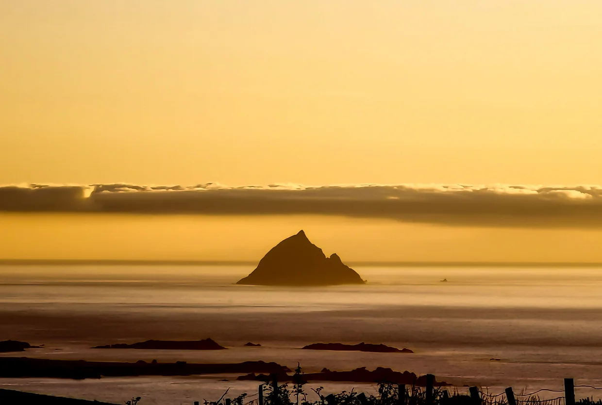
The Skellig Islands are visible from several points along the western stretch, and on a clear day they sit on the horizon looking slightly improbable. Skellig Michael is the one you've heard of: the beehive-hut monastery that became Luke Skywalker's hideout. You can visit it by boat from Portmagee, but landing tours are seasonal, limited, and very weather-dependent, so book far ahead and keep your plans flexible. Even from the mainland, the distant outline on the horizon does the job.
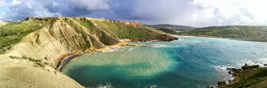
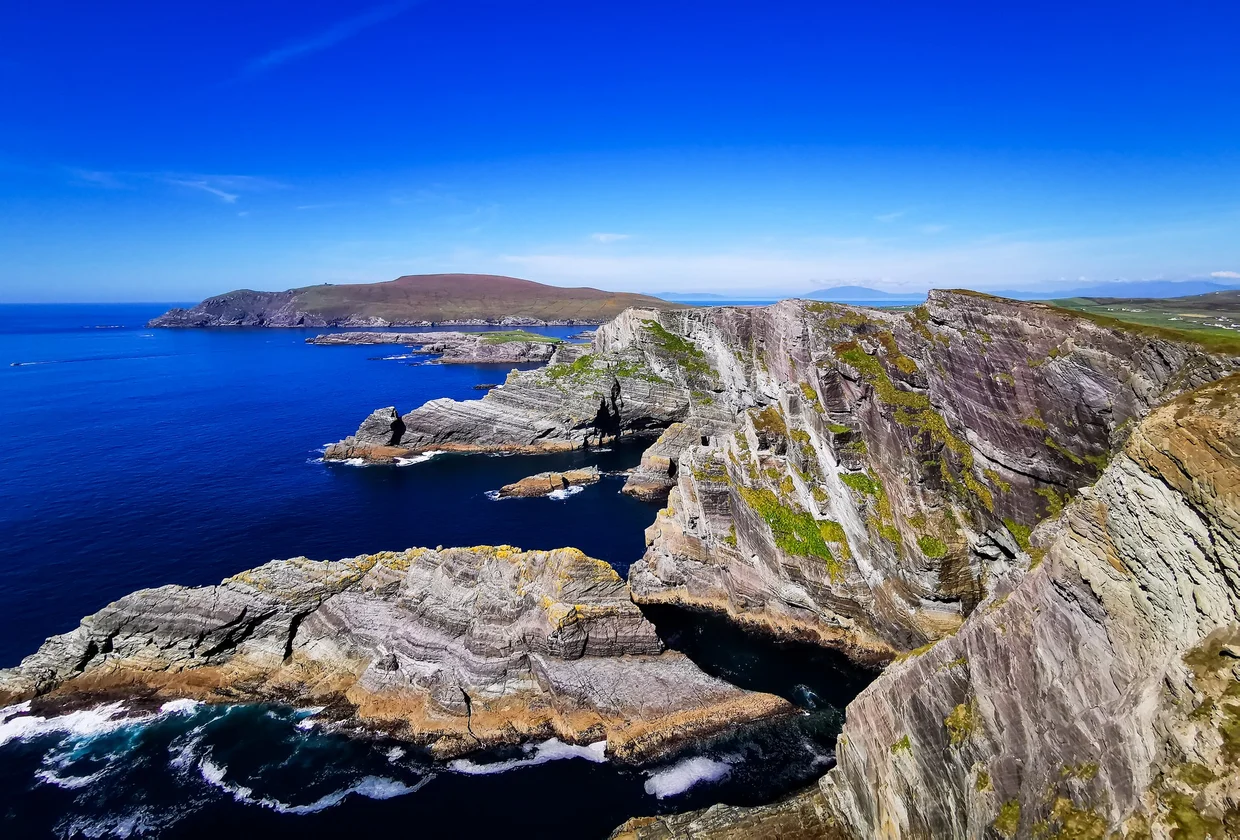
The Kerry Cliffs sit just outside Portmagee, a short detour off the main Ring road, and they are one of the stronger viewpoints on the peninsula. The cliffs drop nearly 300 meters straight into the Atlantic, the rock layered and folded into stripes like geology decided to label its work. There are fenced viewing platforms along the edge, and on a clear day the Skellig Islands sit right there on the horizon. The Kerry Cliffs get a fraction of the visitors that the Cliffs of Moher do, which means you might have the viewing platforms to yourself. If you're already in Portmagee for the Skellig boat tours, this is a 10-minute drive and an easy win.
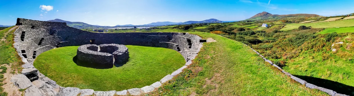
The Cahergall Stone Fort is one of the most impressive early medieval ring forts in Kerry, sitting in a field near Cahersiveen like it has been quietly ignoring everyone since the seventh century. The walls are massive, the interior is open and grassy, and you can walk right in. No ticket, no barrier, no gift shop. Just you and a drystone fortification in a sheep field with a view of the mountains. This is what I like about Ireland's heritage sites: half of them feel like someone forgot to add the ticket office.

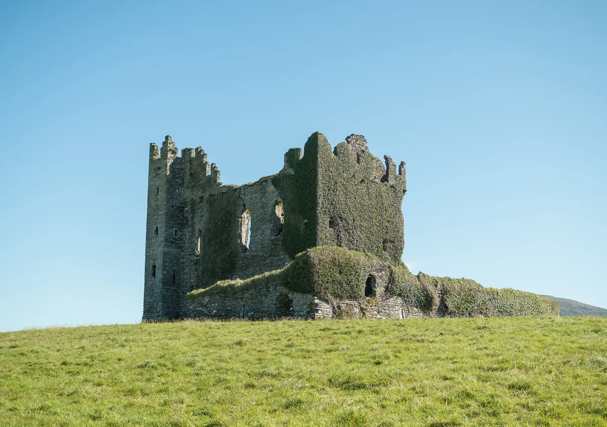
Ballycarbery Castle is nearby, a 15th-century ruin so covered in ivy it looks like nature is slowly eating it. Unfortunately, the castle sits on private land and is officially closed to the public due to safety concerns over its structural stability. You can't walk up to it, but you can see it clearly from the road, and it's worth slowing down for the visual. A crumbling castle on a green hilltop with sheep grazing around it is a lot, visually speaking. Ireland does occasionally lean into the brand.
The Killarney end of the Ring opens up into lakes, mountains, and some of the wider views on the route. Ladies' View (supposedly named because Queen Victoria's ladies-in-waiting loved the panorama) gives you a broad look at the Upper Lake and the surrounding mountains. It is an easy stop, and for once the famous viewpoint is not just a lay-by with ambition.
The Kenmare Stone Circle, locally known as "The Shrubberies," is a Bronze Age monument dating back to somewhere between 2200 and 500 B.C., tucked just off Cromwell's Bridge road in Kenmare town. It's made up of 15 boulders arranged in an unusual egg shape (most Irish stone circles are round), with a central boulder that sets it apart from anything else on the peninsula. It's not Stonehenge. It's not trying to be. But there's something about standing inside a structure that's been here for over 3,000 years, in complete silence, that puts things in perspective. I stood there for about 15 minutes and didn't see another person. That kind of solitude at an ancient site is rare in Europe.

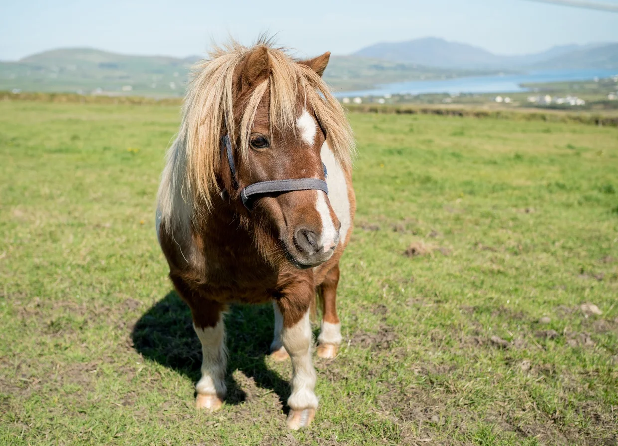
And then there's the pony.
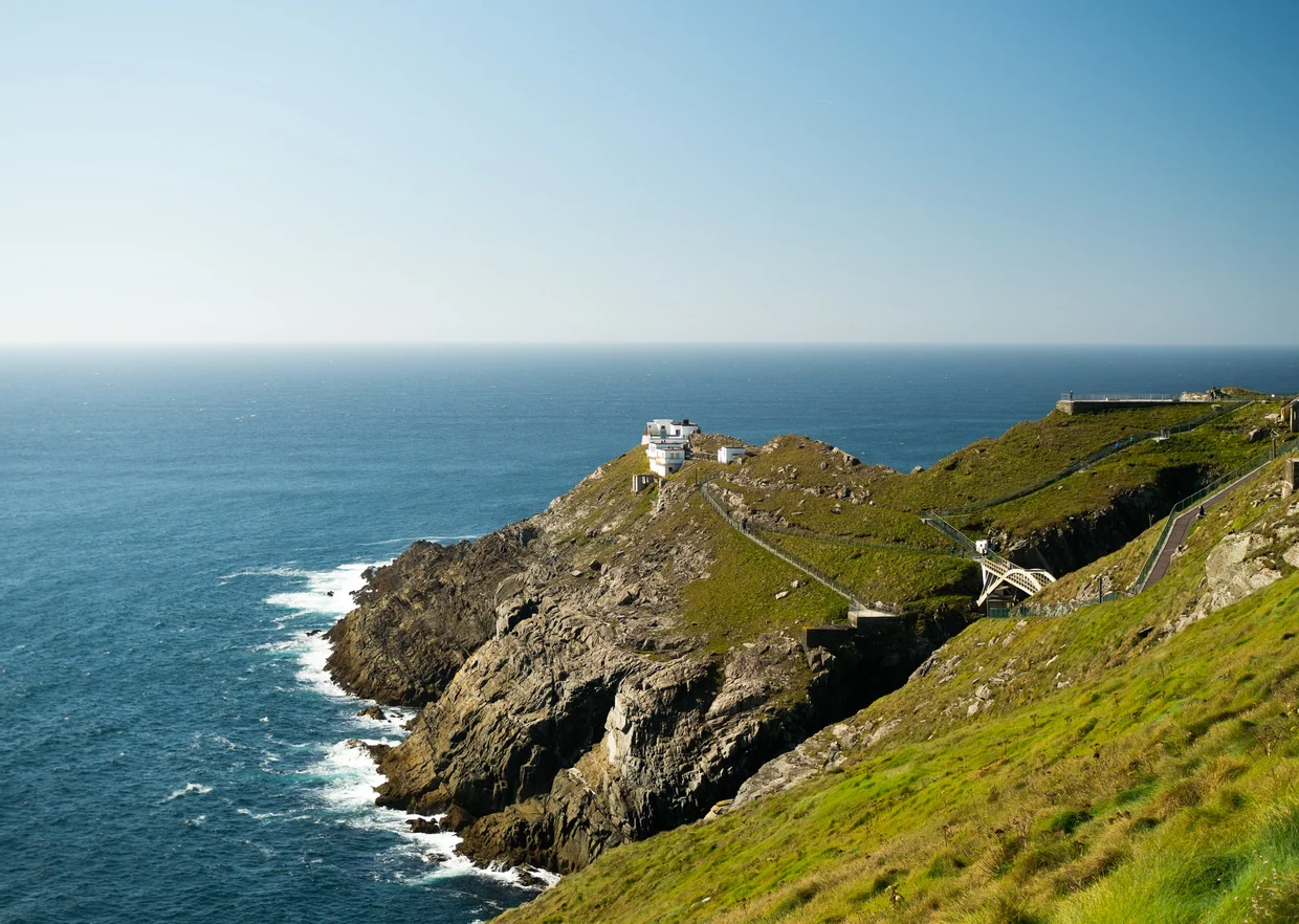
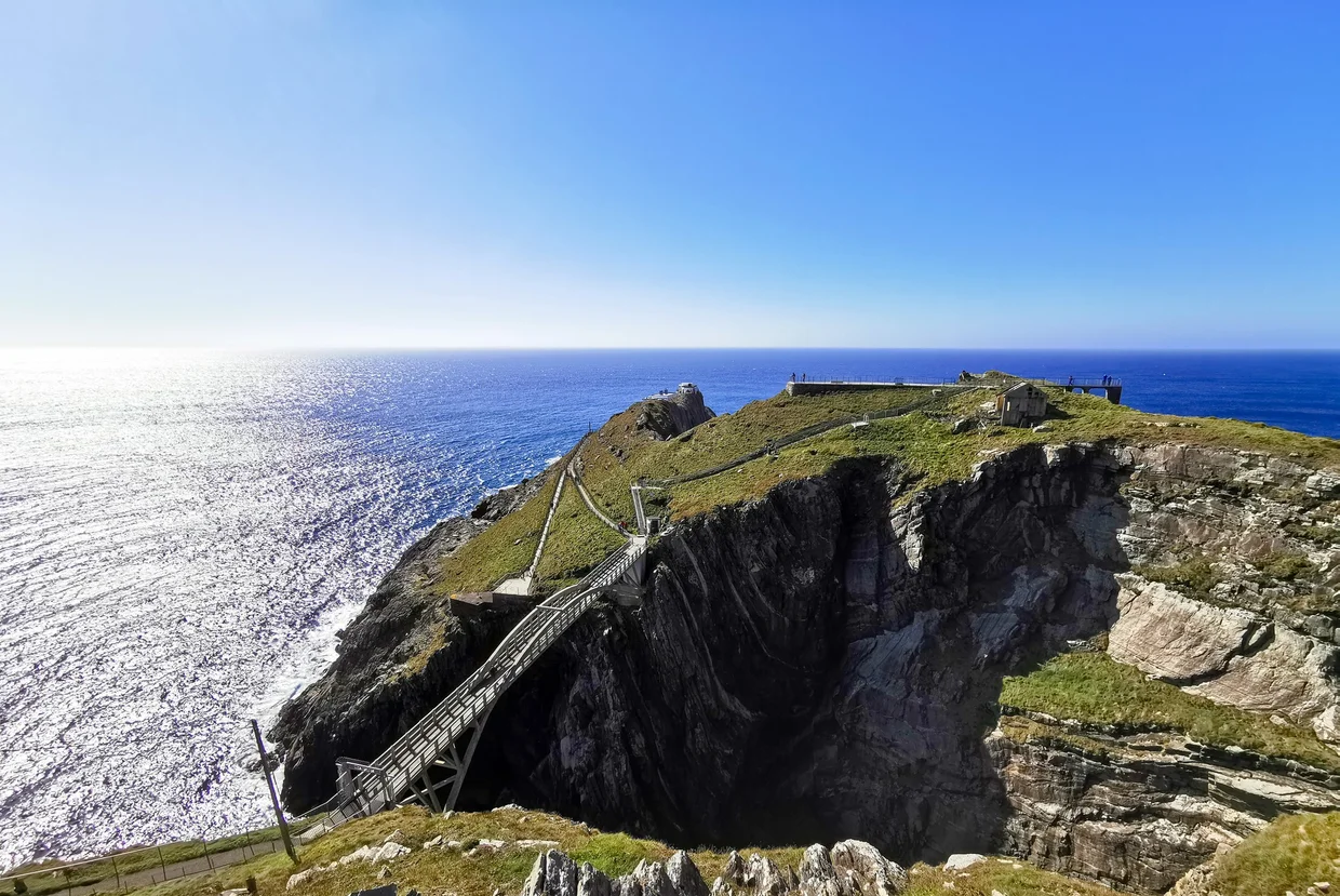
Mizen Head
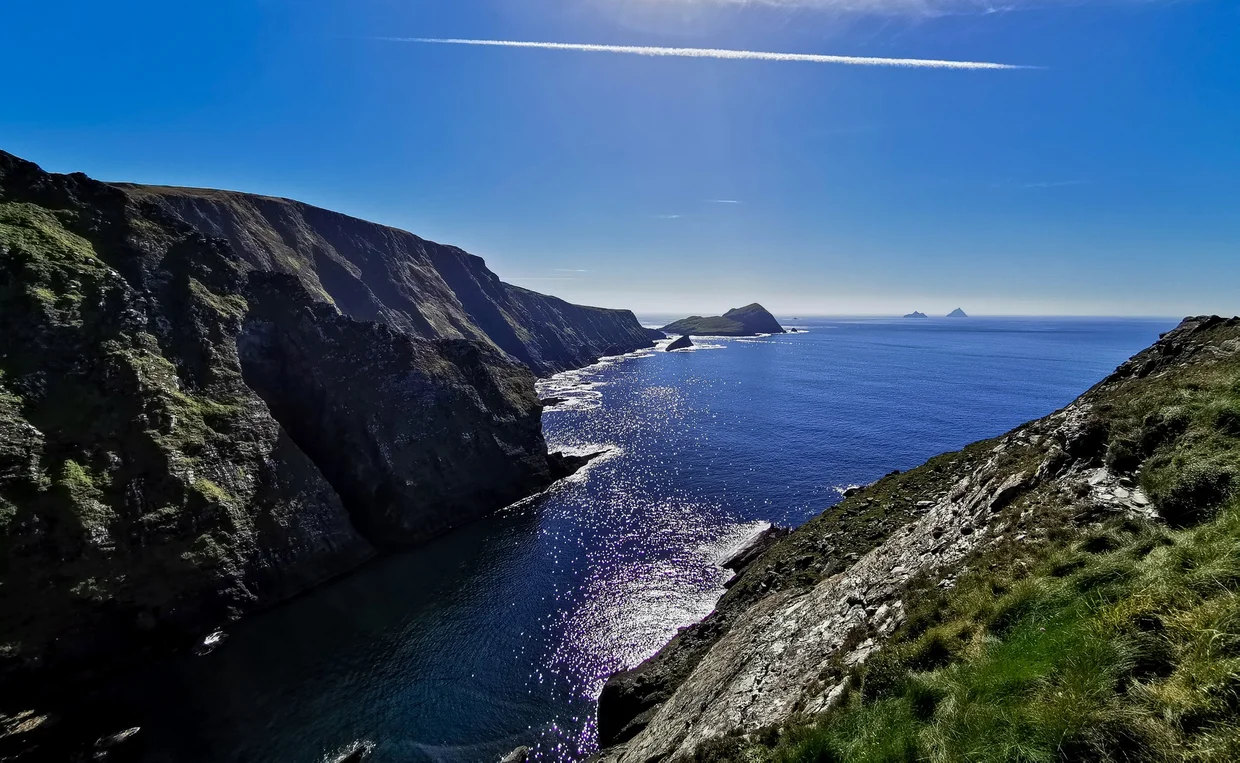
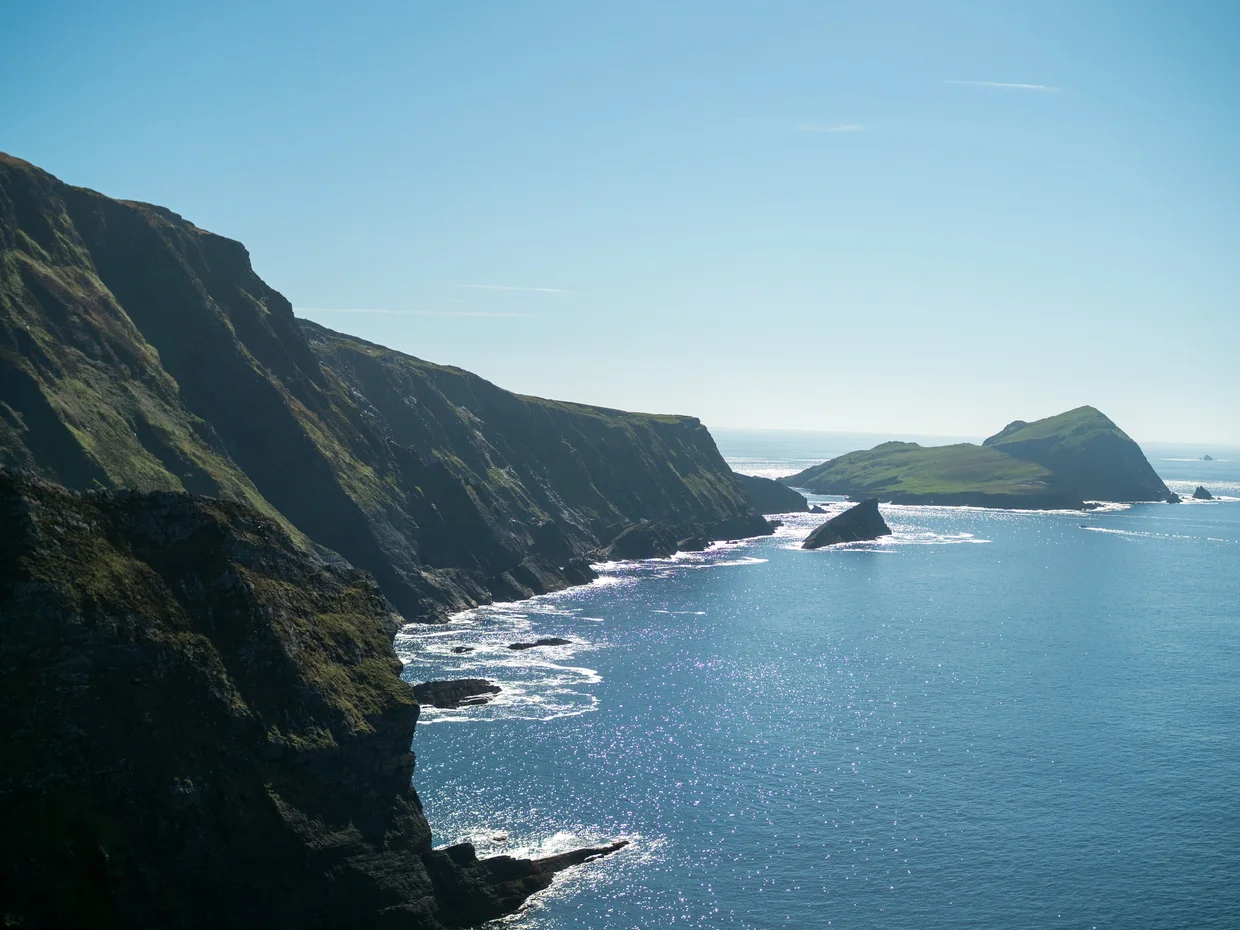
Mizen Head is the most southwesterly point of the Irish mainland, a rugged headland connected to its signal station by a bridge that spans a deep sea gorge. It's about an hour from Kenmare, and it doesn't make it onto every first-time Ireland itinerary. Fair enough. Ireland has more headlands than a person has vacation days.
The drive there takes you through rolling farmland that gradually gets wilder and more exposed until you're on a narrow road with the Atlantic visible on both sides. The visitor center and signal station are perched on the very tip of the headland, connected by a concrete bridge over a gap where the sea churns below. On a windy day (which is most days), crossing the bridge feels like a minor adventure.

The views from the signal station are among the stronger ones on this stretch of coast. You're standing at the edge of Europe, essentially. Nothing but Atlantic between you and North America, plus whatever the weather is doing at your expense. The cliffs around the headland are layered and folded rock, the kind of geology that makes the ocean look less scenic and more like a long-term maintenance problem.
The waters around Mizen Head are surprisingly rich in wildlife. Basking sharks, humpback whales, and dolphins all pass through these waters, and grey seals are a common sight on the rocks below the cliffs. I only managed to spot a few seals sunbathing on a ledge, but even that felt like a bonus. On land, the headland is home to plenty of seabirds, and the wider southwest corner has badgers and foxes roaming the fields and hedgerows after dark.
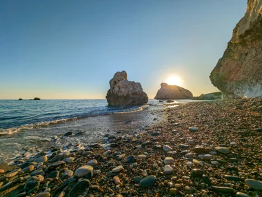
There's also a wide white sand beach at Barleycove just before you reach Mizen Head, sheltered by dunes and backed by hills. On a sunny day a photo could trick you into thinking it was warmer than it is. Then you touch the water and Ireland corrects the record. I walked it for about 20 minutes and saw maybe three other people. The southwest corner of Ireland does not get the traffic that Kerry and Clare get, and that's exactly why it's worth the extra hour.
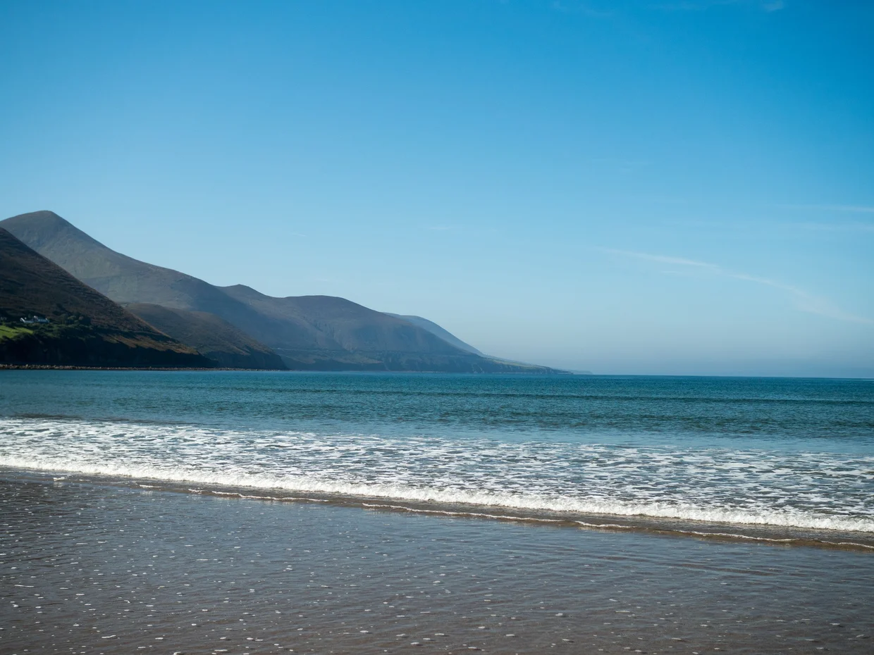
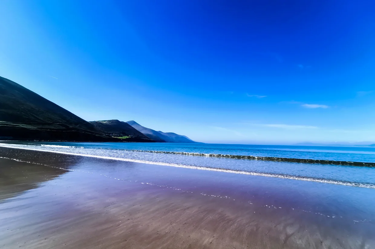
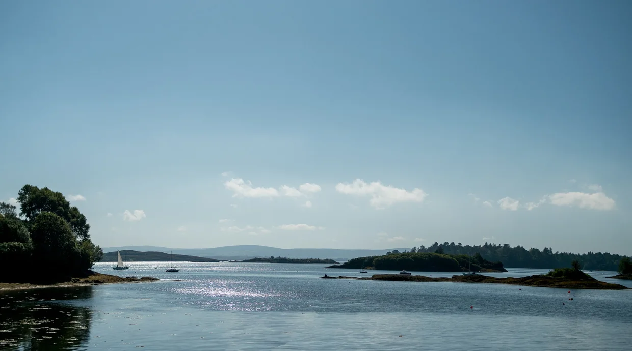
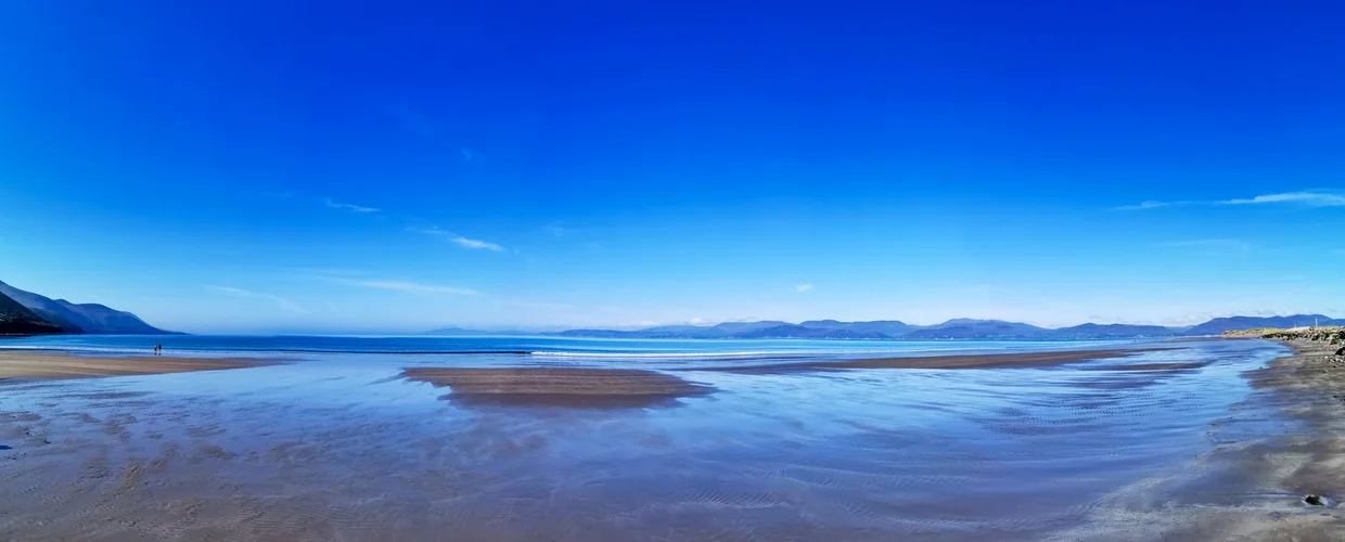
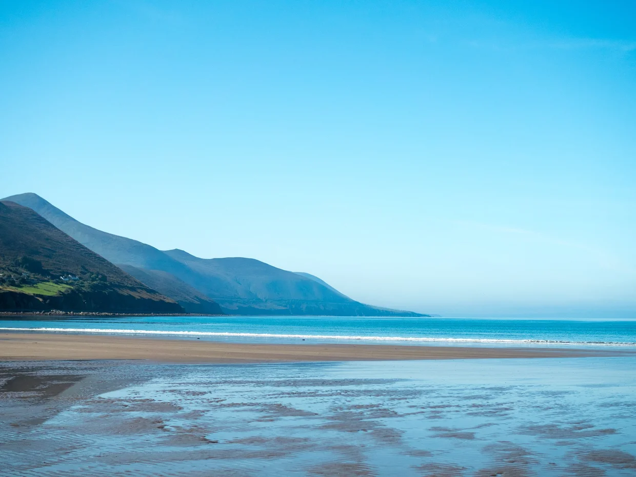
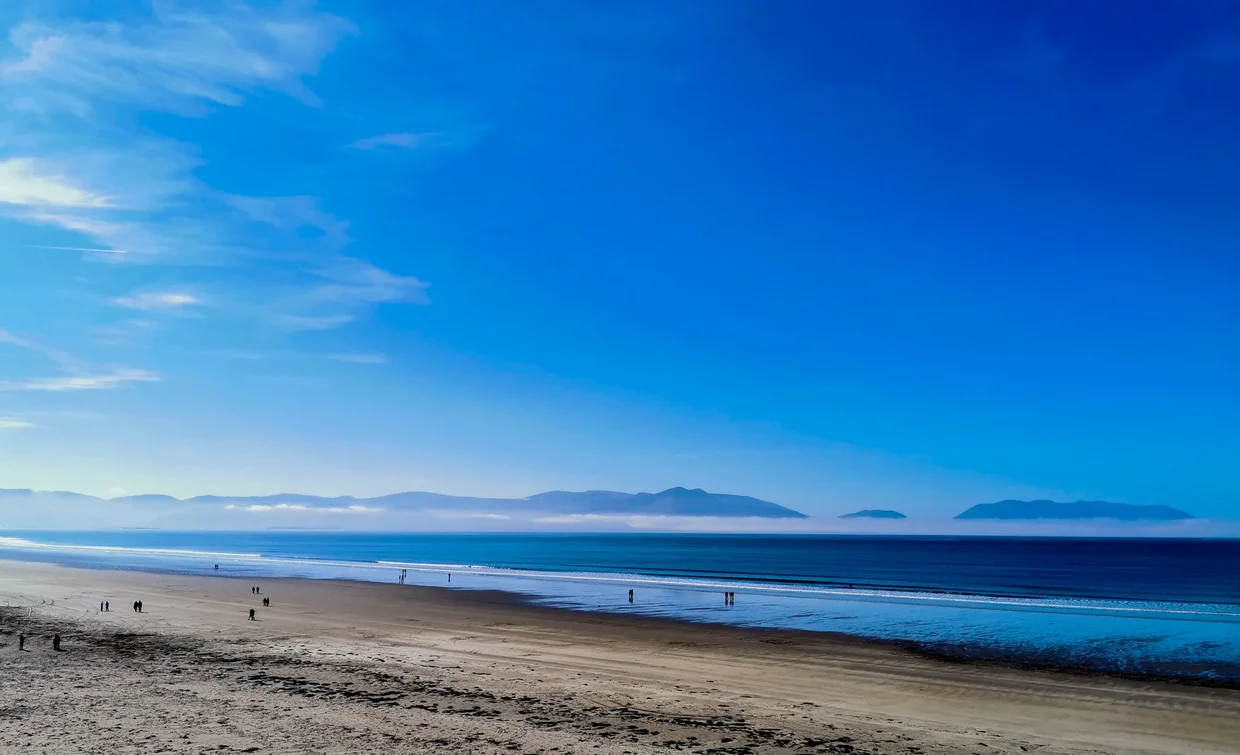
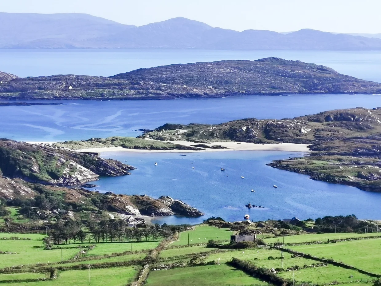
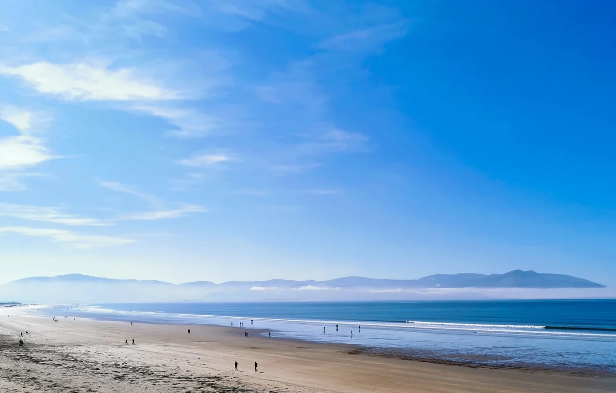
The Beaches
The beaches surprised me. Real sandy beaches. Big, wide ones, often backed by mountains and usually not making a fuss about themselves. You go to Ireland for cliffs and green and rain. You pack layers, not sunscreen. Then you round a corner on a coastal road and there's a beach that would be heavily marketed somewhere warmer, except here the water is about 12 degrees and nobody is pretending otherwise.

Ireland's west coast is full of them. From the Dingle Peninsula down through Kerry and into West Cork, the beaches just keep appearing. Some sit in sheltered bays where the water turns turquoise on sunny days. Others face the open Atlantic, wide and exposed. Many are quiet even in summer. The combination of cold water and unreliable weather does useful crowd control, which means these beaches can feel like discoveries even though they're right there on the road.
You won't swim. Not without a wetsuit, anyway. The Atlantic here makes your feet go numb in about 30 seconds. But walking these beaches is excellent. The sand is firm at low tide, the space is enormous, and the mountains framing everything make the place feel more remote than the map says it is. Some of my nicest moments in Ireland were just standing on a beach with the wind in my face, wondering why nobody had mentioned this part properly.
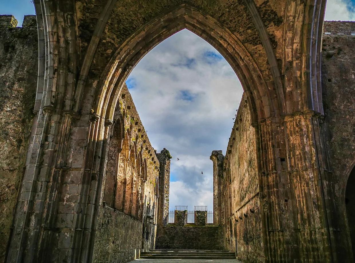
Rock of Cashel
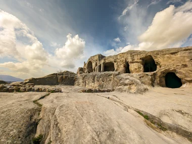
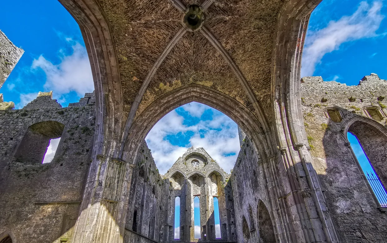
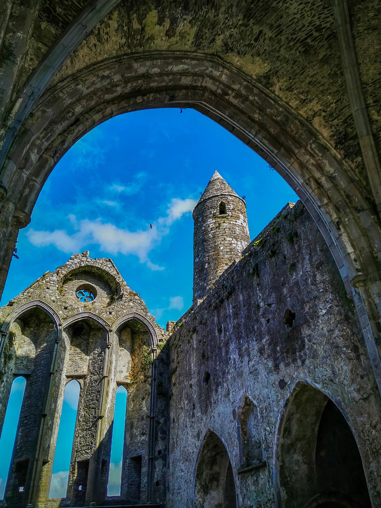
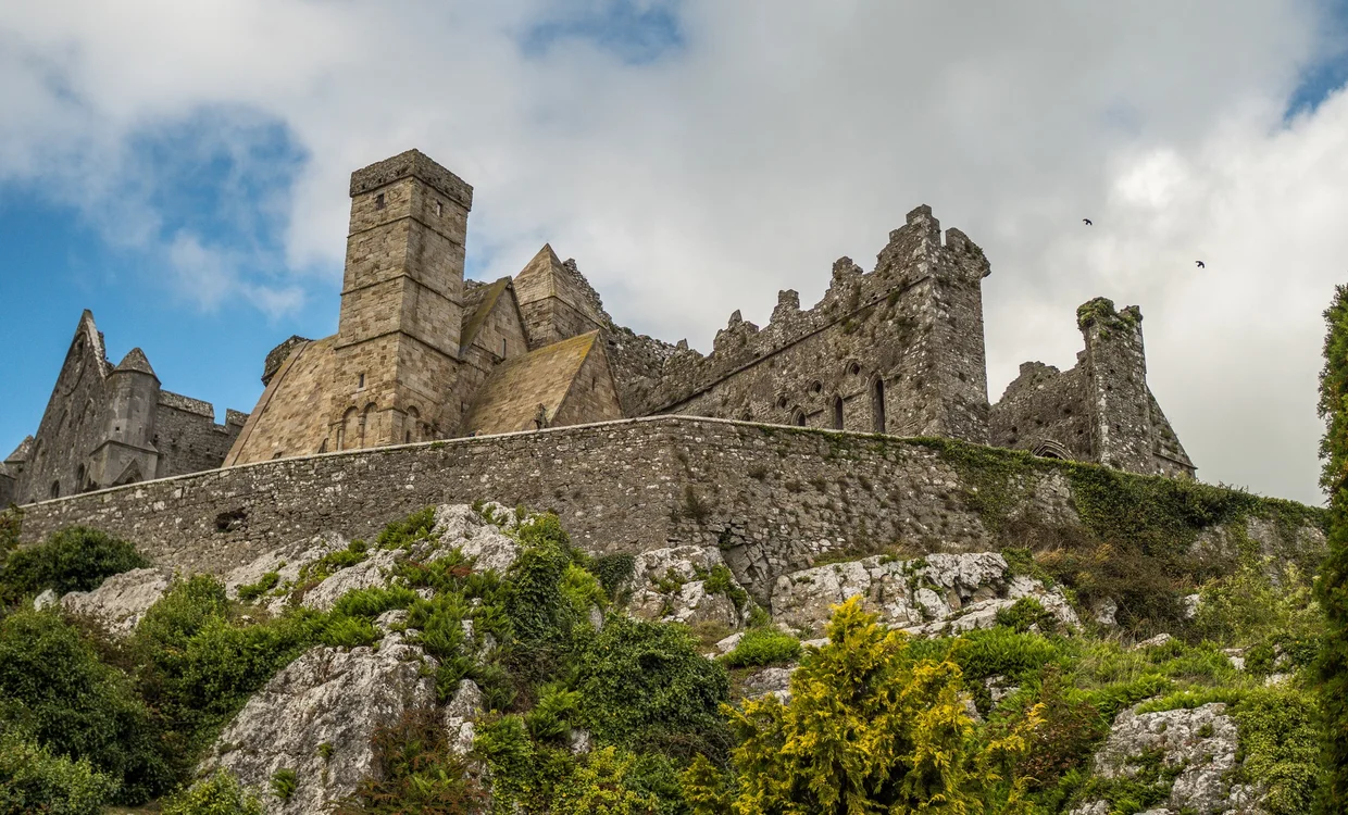
The Rock of Cashel is a cluster of medieval buildings on a limestone hilltop in County Tipperary, visible from miles away, and it works better in person than it does in photos. I stopped here on the drive from Cork back to Dublin, expecting a quick 30-minute visit. I stayed for almost two hours, which is how historical sites win without making a speech.
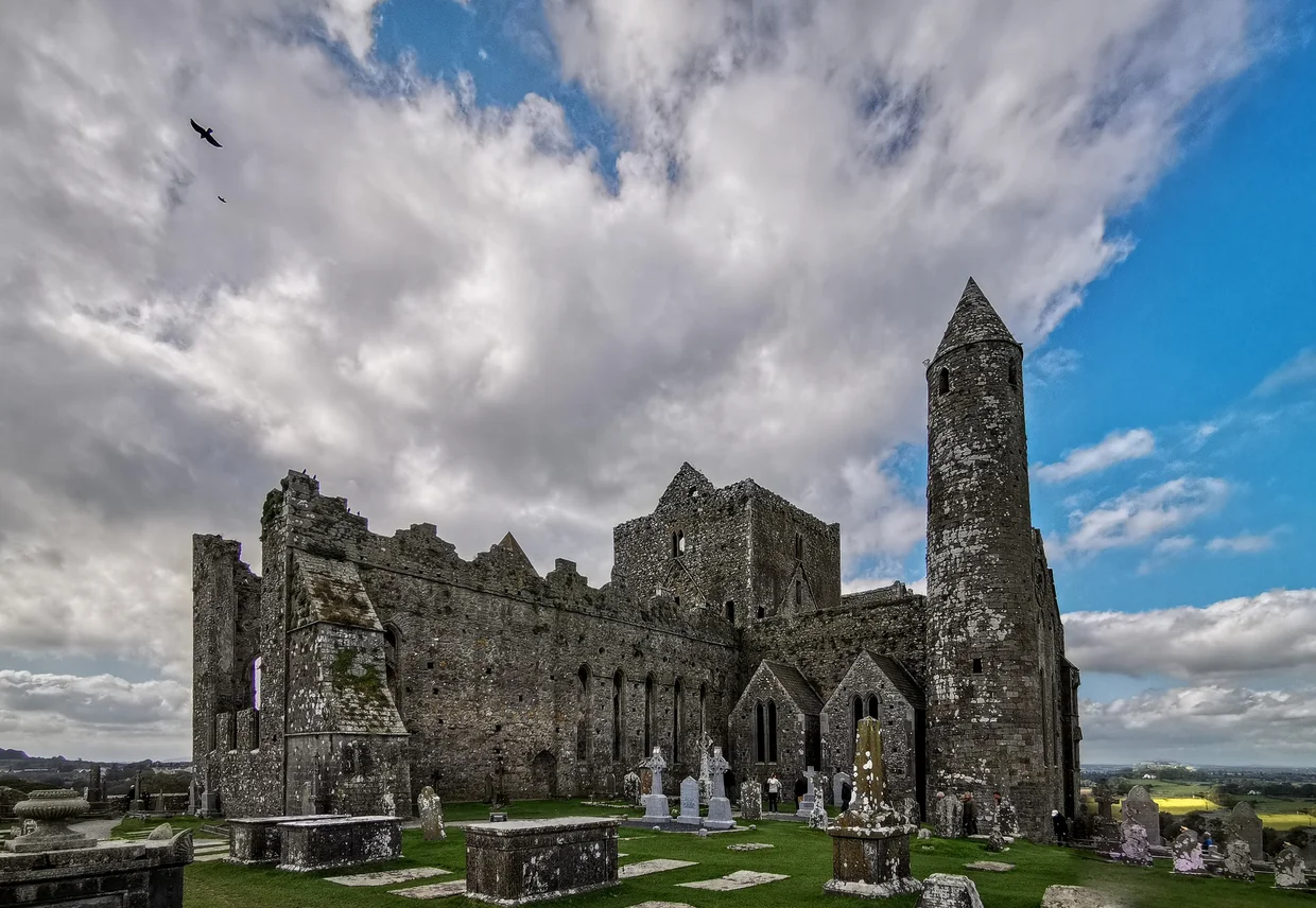
The site includes a 12th-century round tower, a 13th-century Gothic cathedral (roofless but still standing), a Romanesque chapel, and a hall of vicars. The round tower is the oldest structure, built around 1100, and it still stands at its full height. The cathedral is the star, though. Walking through it with the sky where the ceiling should be, looking up through Gothic arches at clouds moving overhead, is quietly excellent.
The detail in the stonework is impressive for something that's been exposed to Irish weather for 800 years. Carved heads, Romanesque arches with chevron patterns, and window frames that still hold their shape despite having lost every other element around them. The round tower in particular is in annoyingly good condition, standing straight and complete while the cathedral around it gradually returns to nature.
Practical note: There's a guided tour that's worth joining. The guides know the history well and point out details you'd walk right past on your own. The graveyard around the site has some beautifully weathered Celtic crosses. The whole visit takes 60 to 90 minutes if you're thorough.
Bring a jacket or something warm: the Rock sits fully exposed on top of a hill, and the wind up there can get seriously chilly even on days that feel mild at ground level. If you're driving between Cork and Dublin, this is a natural stop and one of the better ones of the trip.
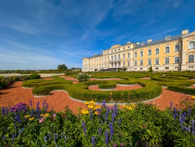
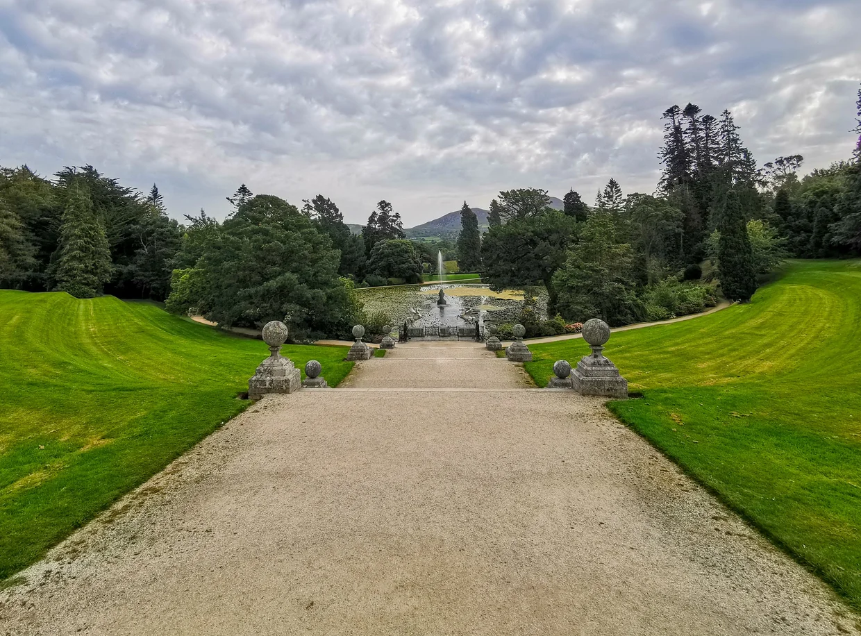
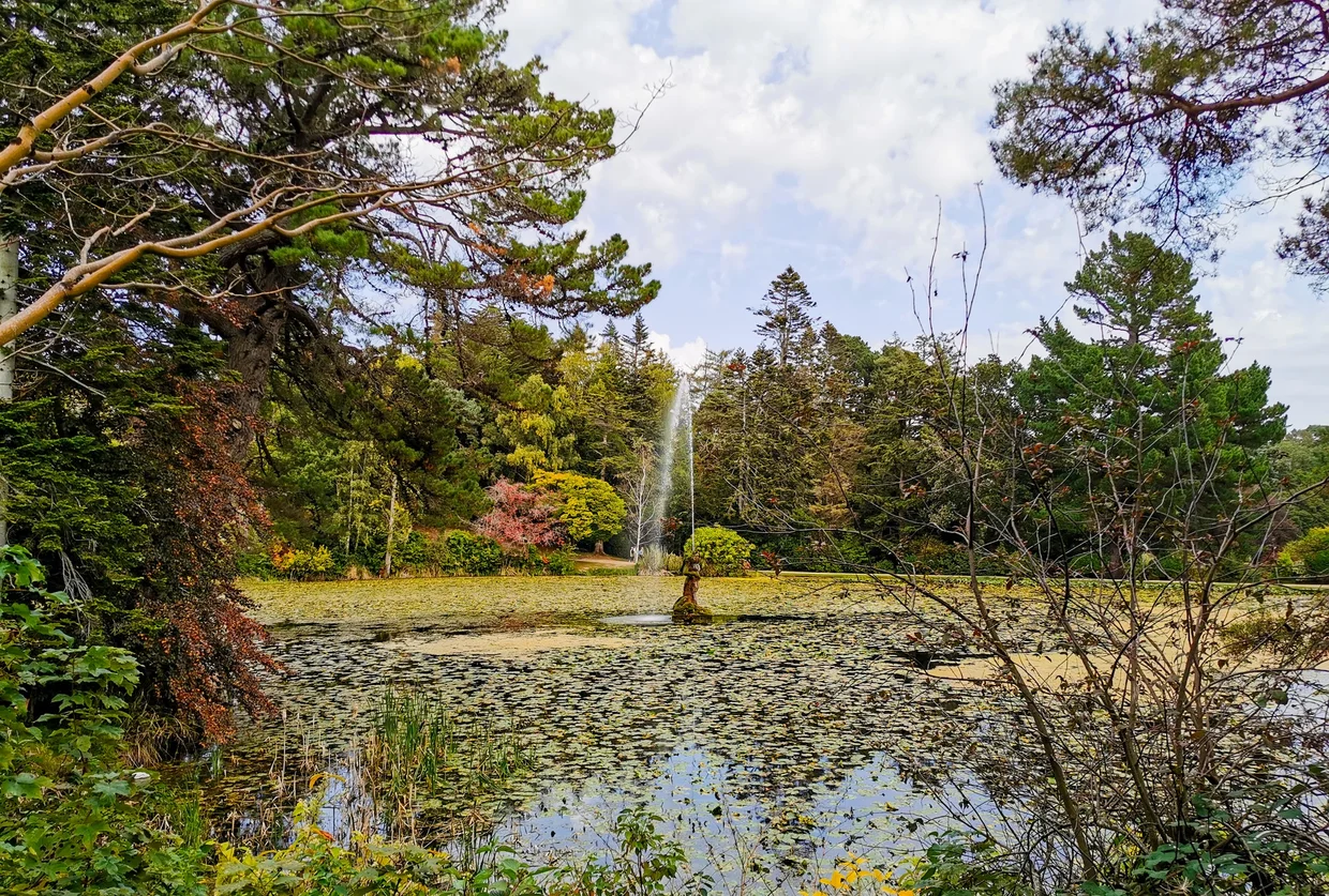
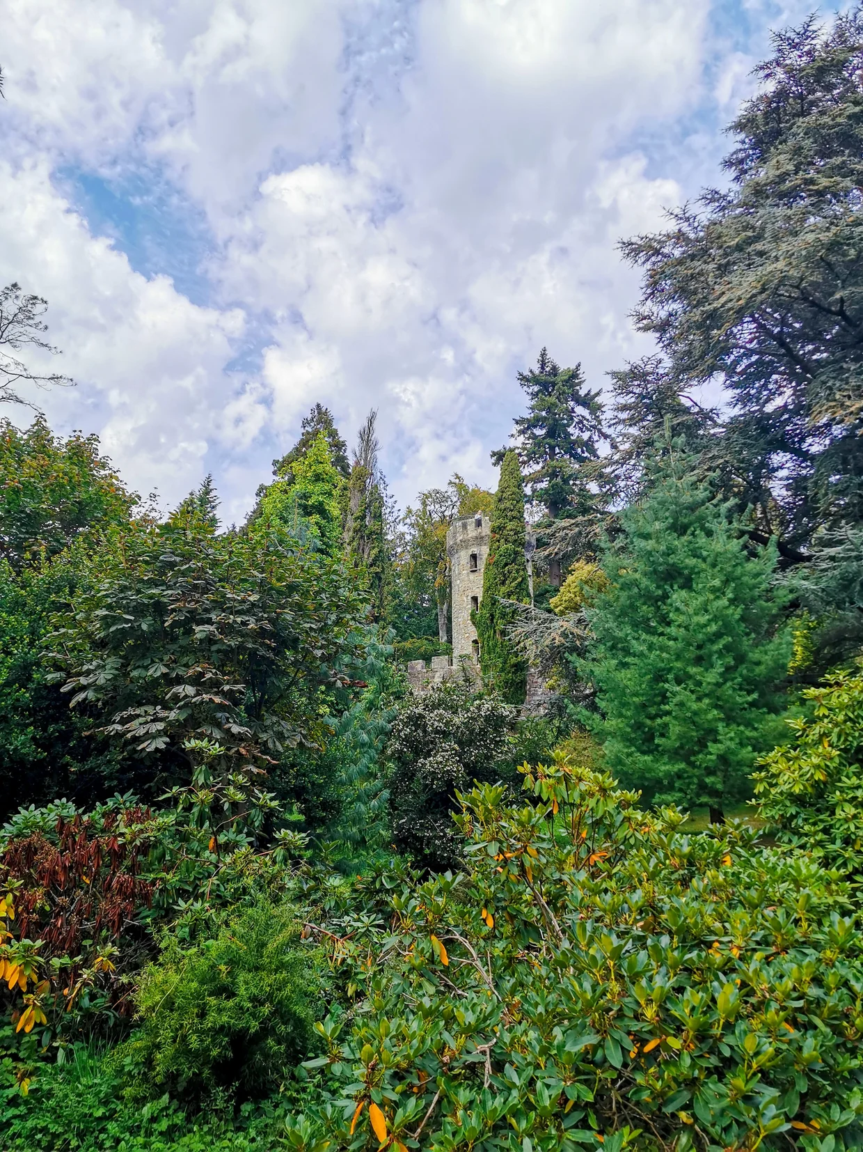
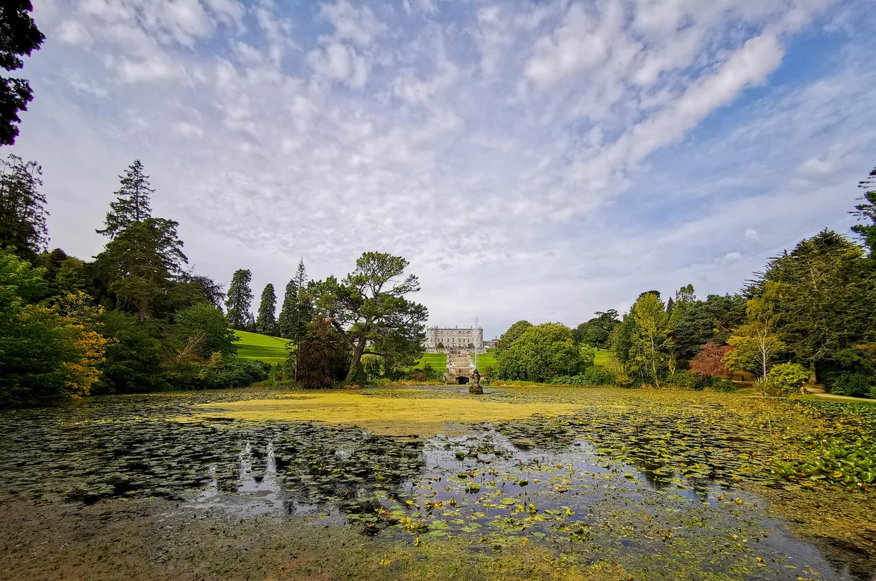
Powerscourt
Powerscourt Estate sits in the Wicklow Mountains south of Dublin, and it's a detour I almost skipped. But I had time before my flight and the reviews were insistent, so I went.
And yeah, they were right.
The gardens cover about 19 hectares and mix formal Italian terraces with wilder Japanese gardens, walled gardens, and wooded areas that feel more like a forest than an estate. The main terrace gives you a view straight down to a lake with the Sugarloaf Mountain framed behind it, all arranged with the subtlety of someone who absolutely knew where the postcard would be taken.

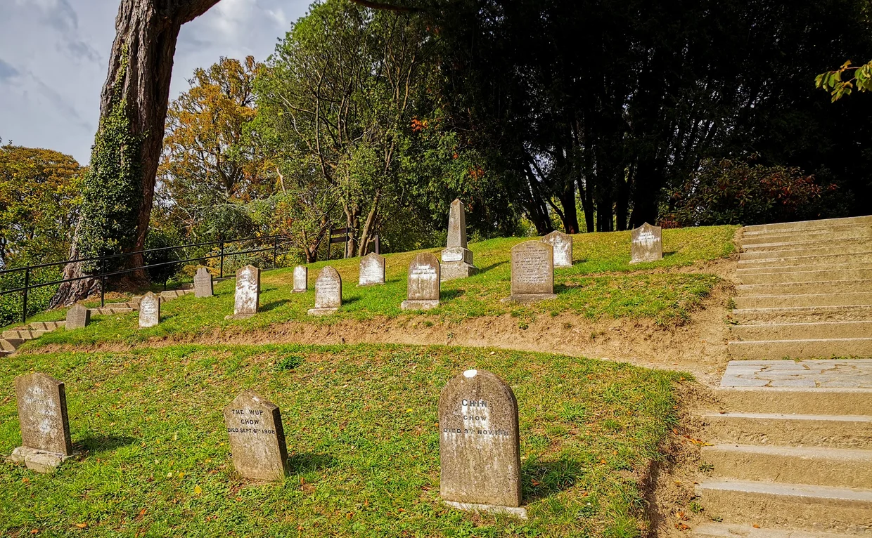
The weirdest and most endearing thing about Powerscourt is the pet cemetery. Tucked away in a corner of the estate, it's a hillside with dozens of small headstones for the dogs, cats, horses, and other animals of the Powerscourt families over the past two centuries. Each stone has a name and often a short inscription. Yeah, my brain immediately went to the movie. No, fortunately nothing creepy crawled out of the ground. It's oddly moving. And probably very, very Irish.
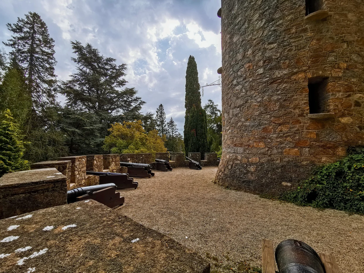
There's also a defensive tower with cannons that gives you a different perspective of the grounds. The whole place has this feeling of quiet grandeur that contrasts nicely with the raw wildness of the west coast. If you've spent a week staring at cliffs and sheep, Powerscourt is a pleasant change of pace before you fly home.
A warning about crowds: When I visited, there was a queue at the main entrance with security checks just to buy tickets and get in. Nothing dramatic on that day, but judging by the queue management structures, there are clearly times when the wait gets very long. You have to go through this regardless of whether you want to see the house or just the gardens. Inside the house was worse. The rooms were packed with people to the point where moving from one to the next was a slow shuffle, and actually seeing anything meant waiting for someone to step aside. It was probably the most crowded sightseeing building I've been in, right after Bran's Castle in Romania. The gardens are the real draw here anyway, so don't feel bad about skipping the house entirely once you're through the gate.
What to Do
There are many things to experience, to see and to do in Ireland. These are my personal highlights.
Cliffs of Moher
Ring of Kerry Drive
Mizen Head Signal Station
See the full what to do in Ireland guide.
Food
Irish food is not gonna win any complexity awards, and that's fine. It knows what it is: hearty, filling, no-nonsense fuel for a country where the weather requires internal heating. If you come expecting culinary fireworks, you're setting yourself up. If you come expecting a solid meal that does exactly what it promises, you'll be happy.
The Full Irish Breakfast is the national institution. Eggs, bacon (back bacon, not the streaky kind), sausages, black and white pudding, toast, grilled tomatoes, baked beans. It's served in every B&B and hotel, and it's the kind of meal that powers you through an entire day of driving without needing lunch. The pudding is the part that scares people. Black pudding is made with blood (yes, actual blood) and it's better than it sounds. White pudding is similar but without the blood, so it's the gateway pudding.
Fish and chips is done well in Ireland, especially along the coast. Fresh cod or haddock, battered and fried, with proper chips (thick cut, not the thin kind). The coastal towns in Kerry do a particularly good version with fish that was probably in the ocean that morning.
Pub food is reliable and consistent. You'll find burger and chips, fish and chips, shepherd's pie, and soup with brown bread on basically every pub menu in the country. The brown bread in Ireland is properly good. Dense, slightly sweet, often homemade. It shows up at every meal and I never got tired of it.
Soda bread deserves its own mention. Dense, crumbly, slightly tangy from the buttermilk, and served with butter at basically every sit-down meal. It's one of those simple foods that makes you wonder why every country doesn't do this.
The food scene in Dublin and Cork is apparently much more varied, with modern Irish cuisine, international options, and actual restaurant culture. But on the west coast and the rural routes? You're eating in pubs and B&B dining rooms, and that's totally fine. The portions are generous, the food is filling, and the prices are reasonable by European standards.
Best Base
Where to Stay
Killarney
The most practical base for the Ring of Kerry and the default choice for a reason. Killarney is a proper town with a wide range of B&Bs, hotels, restaurants, and pubs, plus a national park right on its doorstep. The town itself is tourist-oriented (souvenir shops, jaunting cars, tour operators lining the main street), but step five minutes outside the center and you're in proper lake and mountain scenery. The concentration of accommodation means you'll find options at every price point, and the B&Bs here are well-practiced at feeding you a Full Irish that'll last until dinner. The Ring of Kerry loop starts and ends here, and Killarney National Park is within walking distance. The trade-off is that the town can feel a bit theme-parked in peak season, but it's a solid, no-surprises base.
Getting Around
You need a car. Not debatable. The parts of Ireland I'm talking about on this page are essentially inaccessible without one. There are bus tours that do the Ring of Kerry and the Cliffs of Moher as day trips from various cities, but they rush through everything, stop at predetermined viewpoints for exactly 15 minutes, and you miss all the random discoveries that make a road trip worth doing. Rent a car. Drive yourself.
You drive on the left. If you've never done this before, it takes about two hours to feel normal and about two days to stop occasionally drifting toward the wrong side when you're tired or distracted. The biggest adjustment isn't the side of the road, it's the side of the car: the steering wheel is on the right, which means your spatial sense for the left side of the vehicle is completely off. You'll scrape a hedge or two. Everyone does.
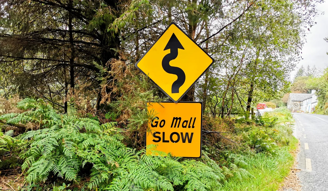
The roads are narrow. Not "European narrow." Irish narrow. On the rural routes, especially in Kerry and on the way to places like Mizen Head, the roads are sometimes barely wider than your car, lined with stone walls or dense hedgerows that leave zero margin for error. When a car comes the other way, one of you pulls into a passing place. When a tractor comes the other way, you reverse until you find one. When sheep are standing in the middle of the road, you wait. There's no rush. "Go Mall" means "slow" in Irish, and you'll see it on signs everywhere. Take the advice.
Road quality varies a lot. The main routes (the N-roads and M-roads) are excellent. The regional roads are fine. The local roads that lead to the most interesting places are often single-track, potholed, and unsigned. GPS helps. Google Maps works well in Ireland. Just trust it when it tells you to turn onto what looks like a farm track, because sometimes the farm track is the road.
Fuel is available in every town, but if you're heading into remote areas of Kerry or West Cork, fill up when you can. There can be surprisingly long stretches without a station.
Parking is easy outside the cities. Most attractions have free or cheap parking. The Cliffs of Moher charge for parking (which doubles as the admission fee). In the countryside, you'll often just pull onto the grass verge.

Best Time to Visit
Ireland's weather is famously unpredictable, and "famously unpredictable" is the polite version. The more accurate version is: it will rain on you. Multiple times a day. In every season. The question is not "will it rain" but "how many times will it rain, and will there be sun between the showers."
The good news: Irish rain is usually soft, short, and followed by the kind of sky that makes your camera look more talented than it is. The light after rain can be excellent. The bad news: sometimes the rain isn't short and the grey just settles in for days. That's the gamble.
May to September is the window. June and July get the longest days (light until 10 PM in June, which is wild for a road trip), and temperatures hover around 15 to 19 degrees. That might sound cool, but with sun and no wind it feels pleasant. August is technically the warmest month but also the wettest of the summer months. September brings shorter days but often surprisingly good weather and fewer tourists.
April and October are shoulder months that can go either way. I've heard stories of people getting a full week of sunshine in April. I've also heard stories of horizontal rain for five straight days. You roll the dice.
November to March is grey, wet, cold, and dark by 4:30 PM. Some people love the moody atmosphere. I'm not one of those people. If you're doing a road trip, you want daylight, and winter Ireland doesn't have much of it.
Costs
Ireland is mid-range by Western European standards. It's cheaper than Iceland or Switzerland, but it's not a budget destination either. The main expenses are car rental and accommodation. Food and attractions are reasonable. Being in rural areas most of the time helps keep costs manageable compared to Dublin prices.
The prices shown here are meant as a rough guide and can vary over time. While I update exchange rates regularly, local prices are typically refreshed only when I revisit the destination.
The biggest money saver in Ireland is the B&B system. Nearly every town and village has guesthouses that include a full Irish breakfast, which means you're basically getting a meal and a half with your room. If you eat a proper Full Irish at 8 AM, you won't need lunch until 3 PM, if at all. That alone cuts your daily food budget significantly.
Published 2023. Last update June 2026